
24.69 inches: Brevard County records historic flood after rainy season ends
Despite the climatological end of the wet season, persistent winds dumped record amounts of rain on Florida's east coast, leaving other regions with severe deficits.
By Ayanda Boateng ·
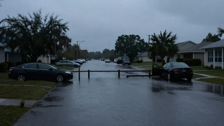
Rainfall totals near Malabar in Brevard County reached 24.69 inches between November 1 and November 5, according to preliminary data from the National Weather Service Weather Prediction Center. This extreme precipitation triggered catastrophic flooding in southern Brevard County, marking a sharp contrast to the rest of the state as Florida entered its dry season. The event occurred after the traditional rainy season had already concluded, demonstrating how atmospheric disturbances can produce severe weather outside the typical summer months.
The National Weather Service in Melbourne identified persistent easterly winds and an upper-level disturbance as the drivers of the storm system. Rainfall was widespread across the region, with 22.75 inches recorded near Grant-Valkaria and 22.00 inches near Palm Bay. Melbourne International Airport received approximately 13.70 inches, while Titusville logged more than 10 inches. Some areas experienced rainfall amounts consistent with a one-in-100-year event, defined as precipitation with a 1% probability of occurring in any given year.
While the east coast faced flooding, other parts of Florida finished the wet season with significant rainfall deficits. In Central Florida, Orlando International Airport recorded only 2.57 inches of rain in September, compared with a normal 6.37 inches. This left the area with a deficit of 3.80 inches for that month alone. From June to September, the Orlando area received 19.39 inches of rain, well below the 29.57-inch average established by the 1991-2020 climate normals. The NWS Melbourne identifies October 15 as the median start of the dry season for the region.
West-Central Florida experienced a mixed outcome. Tampa received 5.47 inches of rain in October, more than double its normal 2.34 inches. However, the city's total rainfall from June to September was 26.39 inches, which is below the 30.24-inch average for that period. Sarasota-Bradenton recorded 9.76 inches in October, making it the fifth-wettest October on record. In contrast, Fort Myers received only 1.21 inches in October, far below its 3.08-inch normal.
North Florida saw an unusually wet start to the month. Jacksonville recorded 11.23 inches of rain during the first 14 days of October, compared with a normal 2.61 inches. By October 14, the city had received 15.52 inches of rain since September 1. Rainfall dropped sharply after October 19, when average temperatures fell to 63 degrees, seven degrees below normal. The city's total rainfall for the June to September period was 25.16 inches, slightly below the 28.81-inch average.
The eastern Panhandle and Big Bend regions also received heavy early October rain. Tallahassee logged 6.71 inches in the first ten days of October, a surplus of 5.50 inches over the normal 1.21 inches. Despite this, the city remained 11.13 inches below its annual average as of October 10. Rainfall ceased by October 27, and temperatures dropped to 42 degrees on October 21 and 22. The statewide precipitation analysis based on NOAA data showed that Florida received approximately 82% of its normal September rainfall, while northern Florida received just 58%.
As of November 5, the heaviest rain in Brevard County had ended, but floodwaters were still receding. The NWS warned that prolonged flooding along the St. Johns River could worsen as runoff continued moving through the basin. Approximately 52% of Florida was experiencing some level of drought by September 29. The transition to the dry season brought cooler temperatures and lower humidity as fall cold fronts replaced the daily summer thunderstorms.