
Saturated Soils Trigger Flash Flooding Across Broward County
Heavy rain returned to South Florida on Wednesday, stranding vehicles and submerging shopping centers before a dry spell begins Thursday.
By Ayanda Boateng ·
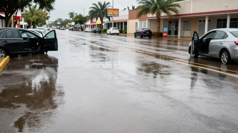
Storms swept from the Atlantic into South Florida early Wednesday, pitting already saturated ground against fresh downpours. The collision produced flash flooding that stranded drivers and submerged commercial lots across Broward County.
The region has endured days of heavy precipitation. Over the past 24 hours, Collier Park recorded 2.91 inches of rain. Miramar logged 2.70 inches, and Pompano Beach measured 2.69 inches. These figures remain preliminary as rain continues to fall in those areas.
North Dixie Highway near the Pompano Beach airport became a focal point for the flooding. Police blocked a section of the road as water rose to ankle height for pedestrians. Drivers abandoned cars when water levels climbed. Similar inundation occurred in Sunrise, where the Amerant Bank arena parking lot filled with water. The Sawgrass Mall area also saw standing water on streets.
In Coral Springs, storm drains overflowed near the Modera apartment complex. Deerfield Beach reported additional street accumulations. Despite the wet conditions, the Broward County public school district confirmed that classes continue on Wednesday. Some private schools have reported different statuses.
Isolated showers will persist through the day, with higher frequency expected in Broward and Miami-Dade counties. A drier air mass begins moving into the region on Thursday. This shift signals the end of the rain cycle, with stable weather and a slight rise in high temperatures expected through the weekend.
Forecasters predict a 10% chance of rain on Thursday, Friday, and Saturday. The high temperature will hold steady at 86 degrees for all three days.
Authorities advise drivers to avoid flooded zones and seek alternate routes. They warn that driving through standing water remains hazardous despite the improving outlook.